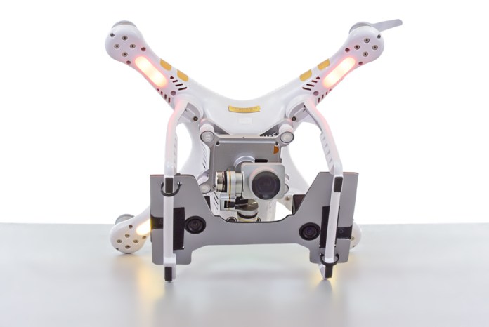
Precision Farming accessible to everyone: the new Phantom 3 Solution now available
Analist Group has devised the new MAPIR Kit to implement the use of the DJI Phantom 3 (Standard, Advanced and Professional) and enable its use to Precision Farming. It is now possible to monitor cultivation condition and rationalize farming operations in order to reduce environmental impact and measure all related activities sustainability.

Remote monitoring via the Drone is an indispensible tool for company decision support system, as a matter of fact besides supplying information on the cultivation health condition it can also be used as foundation for processing and generation of prescription maps and moduling of field activities, supplying benefits from a financial as well as from an environmental point of view.With the MAPIR Kit makes it is finally possible to equip the Drone in all safety with two cameras for the acquisition of multi-spectral images with a Phantom 3. The kit is compatibile with the 6 interchangeable MAPIR cameras, from RGB to IR, from NDVI to ENDVI, this Solution makes a Phantom 3 suitable for every type of application.

Also interessing is the possibility to mount two cameras in addition to the integrated camera for simultaneous acquisition from three cameras, one for photogrammetry and two for Precision Farming. The simplicity and ease with which the MAPIR Kit can be assembled and disassembledis a key feature in addition the essential fact that once it is mounted it has the utmost stability and it is not at all bulky. Thanks to its extreme lightweight the MAPIR Kit has no influence on battery life and flight stability. More information on the MAPIR Kit

MAPIR Kit advantages:
- Practical and economical
- Fast and simple to assemble and disassemble
- It does not change nor interfere with the Phantom 3 aesthetics and use
- No change in flight stability
- Solid and indistructable
- Ideal for Precision Farming and Photogrammetry
- Suitable for all Phantom 3 models (Professional, Advanced or Standard)
Useful links:
Learn what you can do with your DRONE
Learn about all the professional applications with the DRONE
Learn about the Land Survey DRONE Solution
