Analist Group is pleased to welcome a new partner, Andras Cserkuthy with GLT Scan.
Andras Cserkuthy from Budapest has in the last year developed a structured company in providing services for building engineering and architectural designers and operators with the most innovative 3D laser scanning technology ensuring a level of accuracy like never before. This accuracy plays and important role in surveying, designing and documenting buildings and their building engineering, industrial or technological systems.

“What we expect from this partnership is a proficuous and good cooperation for both parties. The partnership with Analist Group will provide us with the know-how on the most innovative technological solutions, our aim is to become the leading company for Hungary in providing these solutions.” said Andras Cserkuthy GLT Scan CEO.

“Analist Group is very excited to start a new international cooperation and will work hard to continuously improve and be leader in providing the best and most updated innovative technologies.” said Mr Iannuzzi Analist Group CEO.
Mr Cserkthy and the GLT Scan team paid a two day visit to the Analist Group premises along with Mr Maté Sipos, head of the Enginnering dpt and Mr Maté Bendeguz Englert Marketing and Communications manager for a full immersion in innovation. A tailored “training course” was ceated for GLT Scan in order for the Hungarian partners to become proficient in the use of the Analist Group Solutions. The teams of both companies focused on
- Data acquisition
- UAV choice, Flight planning
- Data processing, analysis and interpretation
- Complete solutions workflow
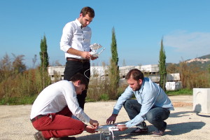
Very interesting was also the workshops in the field which proved essential to fully grasp the potential of complete solutions in terms of a complete tool, the bundle of the most innovative technologies with the softwares and the training provide a real “resolution” to the need of today’s professional to have a complete answer.
A flight was carried out with the expertise of Mr Iannuzzi who magnificently illustrated the best flight techniques and back at the office a session was dedicated to the post processing phase. The GLT Scan team travelled to the quaint village of Chianche where the survey of the old village tower was undertaken.


The DJI Phantom 3 Drone flew over the village of Chianche, the imagery acquired was processed with Pix4D which created the 3D model and the point cloud. The point cloud was then imported into Analist 2016 Cloud Land Survey software where meausurements were carried out in addition to the creation of contour lines, cross sections, land profiles and volume calculations. Then the Analist Group and the GLT Scan teams created a model with OneRay-RT which recreated the beautiful landscapes with the additional feature of the Observatory Tower looking over the valley.


Learn more about the Analist Group Complete Drone Solutions
